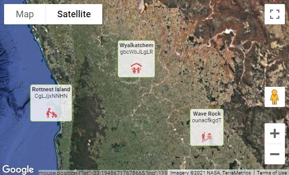
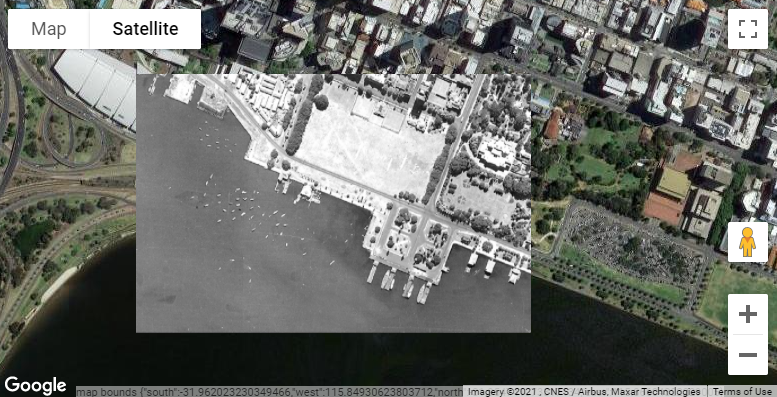
The plugin now supports Overlays, which allows you to add almost any arbitrary HTML or image content to particular points on the map. For example, instead of showing the default red pin, you might want to show a pretty Information card at a location. The cards are clickable as well, and you can use a dynamic action to make your app respond however you wish.
You can even show an image as a map overlay, which will be scaled automatically as the user zooms and pans the map.
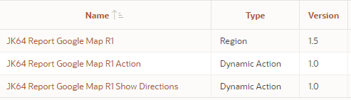
In the previous release I added a companion Dynamic Action “Action” plugin that allows you to declaratively perform actions on the map. This release fixes a few bugs in that plugin, and also adds a new, second companion Dynamic Action plugin: Show Directions. This plugin allows you to invoke the Directions API on the map between one location and a destination without needing to write JavaScript. The locations may be specified with static values (lat,lng coordinates or addresses), from items on your page, JavaScript expressions, or jQuery selectors. The travel mode (e.g. driving, bicycling, etc.) can also be specified the same way.
The Australian Oracle User Group is hosting a series of webinars this year and on 17 February I’ll be speaking about how to add an interactive Google Map to your APEX application. If you’re using APEX and want to see how easy it can be to integrate Google Map capabilities into your application, this is for you.
My session is at 9am in Perth time (1am UTC) – which is:
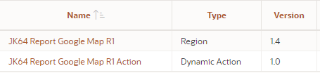
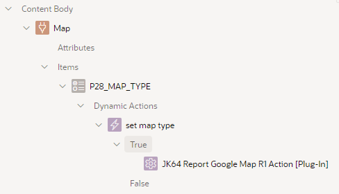
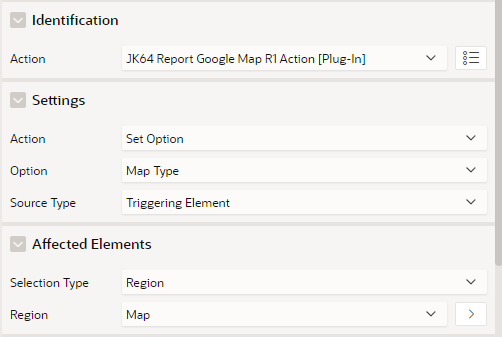
The Dynamic Action plugin, called JK64 Report Google Map R1 Action, allows you to implement any of a range of custom behaviours on your map region. If installed, you can make the map respond to user behaviour or other events without needing to resort to writing your own custom JavaScript.
You can add a dynamic action to modify a variety of options and attributes of the map, execute searches, pan and zoom, load features via geoJson, and more – and these can be based on the value of items on your page, or via JavaScript expressions that you specify.
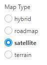
This is implemented as a radio item with a dynamic action on the Change event:
The dynamic action has the following attributes:
Note that in this case, it sets an Option – Map Type, based on the triggering element (the P28_MAP_TYPE item). The Affected Elements is required, and must refer to the map region that we want to change.
Notice anything missing? That’s right – No Code needed!
The plugin makes it easy to customise which of the default Google Map controls (buttons, etc.) are shown to the user:
Full Screen control
Map Type control
Rotate control
Scale control
Street View Pegman control
Zoom control
Other options that can be set include:
Clickable Icons
Disable default UI
Gesture Handling
Heading
Keyboard shortcuts
Map Type
Maximum Zoom level
Minimum Zoom level
Restrict search to Country
Styles
Tilt
Zoom level
In addition, the plugin allows you to restrict the map to a set of bounds, via the Restrict to Bounds or Restrict to Bounds Strict Mode actions.
Another enhancement included in this release is explicit support for the Table / View data source. This is simple to use, although not quite as flexible as the SQL Query option. Your table or view must include columns with the correct column names expected by the selected Visualisation – for example, if your Visualisation is Pins, the table or view must have columns named lat, lng, name and id. Click the Help tab on Table Name for more details, or review the WIKI (https://github.com/jeffreykemp/jk64-plugin-reportmap/wiki/SQL-Query-Examples).
NOTE: the plugin supports APEX 18.2 and later. It is no longer planned to include backports for older versions of APEX.
A big thanks to many APEX developers around the world who have installed and used the map plugin over the years. Your suggestions, questions and bug reports have contributed a great deal to improving the plugin.
Over the past couple of weeks I’ve been working on an overhaul of my Google Maps region for Oracle Application Express. This free, open-source plugin allows you to integrate fully-featured Google Maps into your application, with a wide range of built-in declarative features including dynamic actions, as well as more advanced API routines for running custom JavaScript with the plugin.
Route map
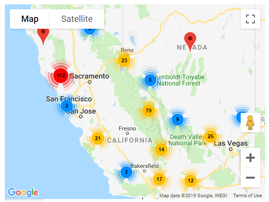
Marker Clustering
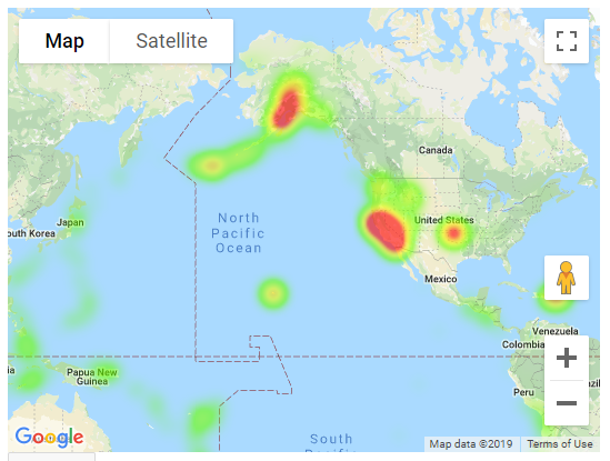
Geo Heatmap
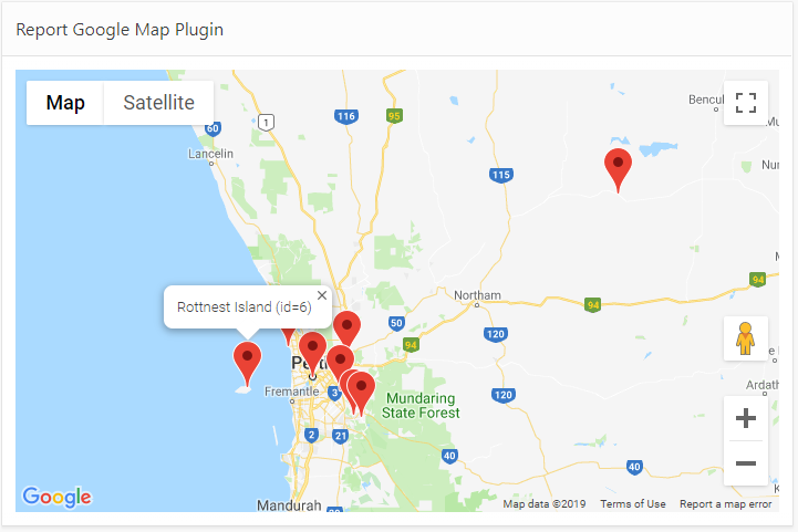
Report Map
The plugin has been updated to Oracle APEX 18.2 (as that is the version my current system is using). Unfortunately this means that people still on older versions will miss out, unless someone is willing to give me a few hours on their APEX 5.0 or 5.1 instance so I can backport the plugin.
EDIT: Release 1.0.1 includes some bugfixes and a backport for APEX 5.0, 5.1 and 18.1.
The plugin is easy to install and use. You provide a SQL Query that returns latitude, longitude, and information for the pins, and the plugin does all the work to show them on the map.
The plugin has been rewritten to use the JQuery UI Widgets interface, at the suggestion of Martin D’Souza. This makes for a cleaner integration on any APEX page, and reduces the JavaScript footprint of each instance on the page if you need two or more map regions at the same time. This represented a rather steep learning curve for me personally, but I learned a lot and I’m pleased with the result. Of course, I’m sure I’ve probably missed a few tricks that the average JavaScript coder would say was obvious.
The beta releases of the plugin (0.1 to 0.10) kept adding more and more plugin attributes until it hit the APEX limit of 25 region-level attributes. This was obviously not very scaleable for future enhancements, so in Release 1.0 I ran the scythe through all the attributes and consolidated, replaced, or removed more than half of them – while preserving almost every single feature. This means v1.0 is not backwards compatible with the beta versions; although many attributes are preserved, others (including the SQL Query itself, which is rather important) would be lost in the conversion if the plugin was merely replaced. For this reason I’ve changed the Internal ID of the plugin. This is so that customers who are currently using a beta version can safely install Release 1.0 alongside it, without affecting all the pages where they are using the plugin. They can then follow the instructions to gradually upgrade each page that uses the plugin.
All of the plugin attributes relating to integrating the plugin with page items have been removed. Instead, it is relatively straightforward to use Dynamic Actions to respond to events on the map, and an API of JavaScript functions can be called to change its behaviour. All of this is fully documented and sample code can be found in the wiki.
New features include, but are not limited to:
Marker Clustering
Geo Heatmap visualisation (this replaces the functionality previous provided in a separate plugin)
Draggable pins
Lazy Load (data is now loaded in a separate Ajax call after the page is loaded)
The plugin attributes that have been added, changed or removed are listed here.
If you haven’t used this plugin before, I encourage you to give it a go. It’s a lot of fun and the possibilities presented by the Google Maps JavaScript API are extensive. You do need a Google Maps API Key which requires a Google billing account, but it is worth the trouble. It is recommended to put a HTTP Referer restriction on your API Key so that people can’t just copy your public key and use it on their own sites. For more information refer to the Installation Instructions.
If you are already using a beta version of the plugin in your application, please review the Upgrading steps before starting. Don’t panic! It’s not quite as simple as just importing the plugin into your application, but it’s not overly complicated. If you were using any of the Page Item integration attributes, you will need to implement Dynamic Actions to achieve the same behaviour. If you had any JavaScript integrations with the plugin, you will need to update them to use the new JQuery UI Widget API calls. I am keen for everyone to update to Release 1.0 as soon as possible, so I will provide free support (via email) for anyone needing help with this.
I am very keen to hear from everyone who is using the plugin, and how it is being used – please let me know in the comments below.
If you notice a bug or have a great idea to enhance the plugin, commenting on this post is not the best place – instead, please raise an issue on GitHub.